[{"id":2700182,"handle":"frontpage","updated_at":"2023-11-27T20:30:04-05:00","published_at":"2010-10-20T09:40:10-04:00","sort_order":"manual","template_suffix":null,"published_scope":"global","title":"Frontpage","body_html":null},{"id":7391174,"handle":"maps","updated_at":"2023-11-27T14:25:09-05:00","published_at":"2012-04-27T09:36:15-04:00","sort_order":"alpha-asc","template_suffix":null,"published_scope":"global","title":"Maps","body_html":"\u003cp\u003eThe Archives of Michigan houses over 10,000 maps.\u0026nbsp; The images within this collection were hand-picked by staff as beautiful representations of the state of Michigan. \u003cbr \/\u003e\r\n\u003c\/p\u003e\r\n"},{"id":2841342,"handle":"prints","title":"Prints","updated_at":"2023-11-26T00:25:01-05:00","body_html":"\u003cmeta charset=\"utf-8\"\u003e\n\u003cblockquote\u003e\n\u003ch3\u003eOur images are from the historical collections of the Archives of Michigan and printed on archival velvet paper.\u003c\/h3\u003e\n\u003c\/blockquote\u003e","published_at":"2010-11-17T14:39:54-05:00","sort_order":"best-selling","template_suffix":"","disjunctive":false,"rules":[{"column":"type","relation":"equals","condition":"Prints"}],"published_scope":"global"}]
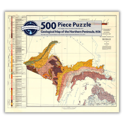
Geological Map of the Northern Peninsula, 1936 Print
Regular price
$35.00
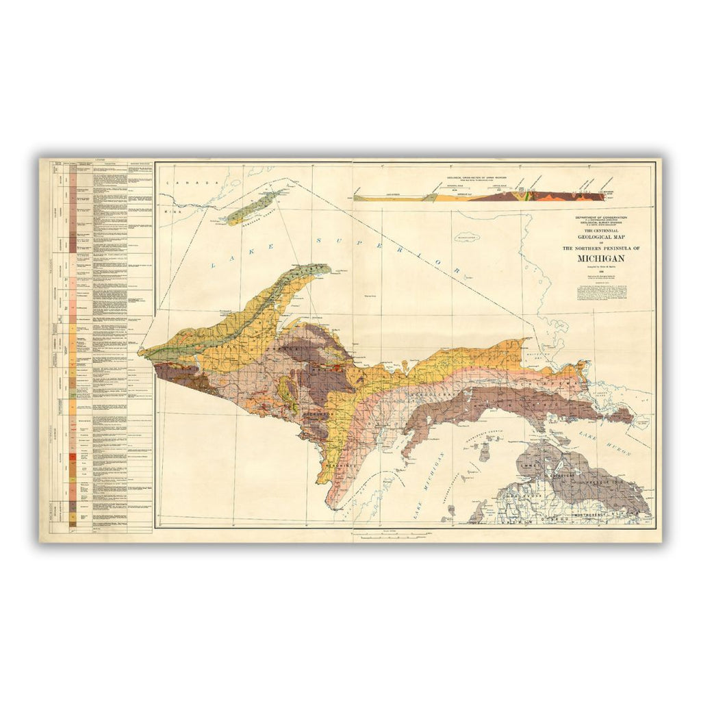
This geological map of Michigan's upper peninsula was produced by the Department of Conservation in 1936 as part of Michigan's centennial. The map's legend is very detailed with descriptions of different geological areas.
Features a historical image from the collections at the Archives of Michigan. Printed on archival velvet paper in Lansing, Michigan.
*Original image dimensions may alter final print size*