Michiganology ™️
Tourist's Pocket Map of Michigan, 1839 Print
Regular price
$35.00
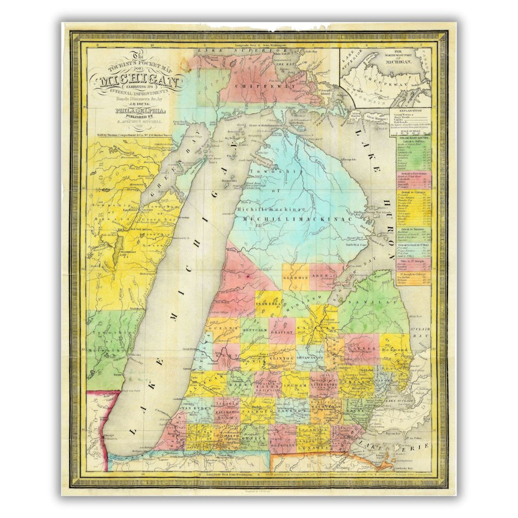
This 1839 "Tourist's Pocket Map of Michigan" once exhibited more than internal improvements, roads and distances. First published by S. Augustus Mitchell in 1834, the map went through a variety of changes from its original publication date to 1846. It was called a "Tourist's Pocket Map" as a result of its literal function. It could be folded into a small 12x7.5-inch booklet that could fit into any tourist's pocket; the original is 18x22 inches.
Features a historical image from the collections at the Archives of Michigan. Printed on archival velvet paper in Lansing, Michigan.
*Original image dimensions may alter final print size*